
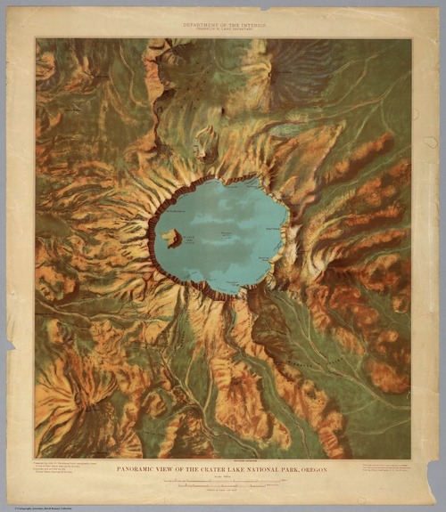
1914 Relief map of Crater Lake National Park
Slate has an article up with examples and history of six beautiful relief maps that were drawn in 1914 by my good friends at the US Geological Survey.
I love me some good historical maps and these are beautiful!
via Maptacular, Slate’s The Vault and images from David Rumsey Map collection